Oct 2, 2023 | 3D Laser Scanning, Administrator, aerial survey, Bookkeeper, Boundary Survey, Constructionline, Drone, Engineering Survey, GNSS/GPS Survey, Land survey, Landform Monitoring, Measured Building Survey, Setting Out, Structural Monitoring, Surveying Course, Topographical Survey, UAS, UAV, Volumetric Survey
There has been a lot going on this past year here at J C White, with plenty of work coming in, new equipment to master, and three new members of staff, all of which has kept us busy in the office and on site, and away from updating the website! In October 2022 we...

Jun 4, 2018 | 3D Laser Scanning, aerial survey, Boundary Survey, GNSS/GPS Survey, Land survey, Measured Building Survey, Setting Out, Structural Monitoring, Surveyors in Kent, Topographical Survey, UAS
Business is Booming! J C White Geomatics is happy to report that right now we are busier than ever! Business is booming! J C White Geomatics is happy to report that right now we are busier than ever. We have many ongoing jobs all over Kent as well...
Apr 9, 2018 | aerial survey, Land survey, PfCO, Surveyors in Kent, Topographical Survey, UAS
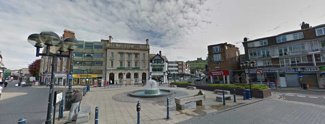
Dover Town Centre Topographical Survey JC White Geomatics’ surveyors braved the Arctic conditions of early March to undertake a detailed survey in Dover Town Centre. An accurate base plan was produced enabling the District Council to carry out its environmental...

Oct 30, 2017 | aerial survey, Measured Building Survey, PfCO, Topographical Survey, UAS, Volumetric Survey
Spreading our wings with aerial surveys J C White Geomatics have their own UAV (drone) pilot! We are now spreading our wings with aerial surveys. Employee Sam Hindess has now successfully completed his PfCO (Permission for Commercial Operations) Training and is now...