Our PfCO qualified UAV pilot has been capturing data with our drone for an ever-growing range of projects. Most recently Deep Ocean engaged our drone services to conduct a detailed topographical survey of Pegwell Bay beach two years after the burial of the Nemo cable, a sub-sea electricity cable linking the UK and the continent. Using UAV photogrammetry Joe surveyed ground levels at low tide on an expanse of sand. The featureless nature of the sand posed challenges as regards fixing the photography which our survey team overcame by creating ground control using sea weed and crosses made from biodegradable material.
We have also recently used the UAV to capture photography and create a 3D model of cliff erosion at Sunny Sands in Folkestone. From this data we extracted levels to define the shape and topography of the cliff and beach to help engineers assess stabilisation measures.
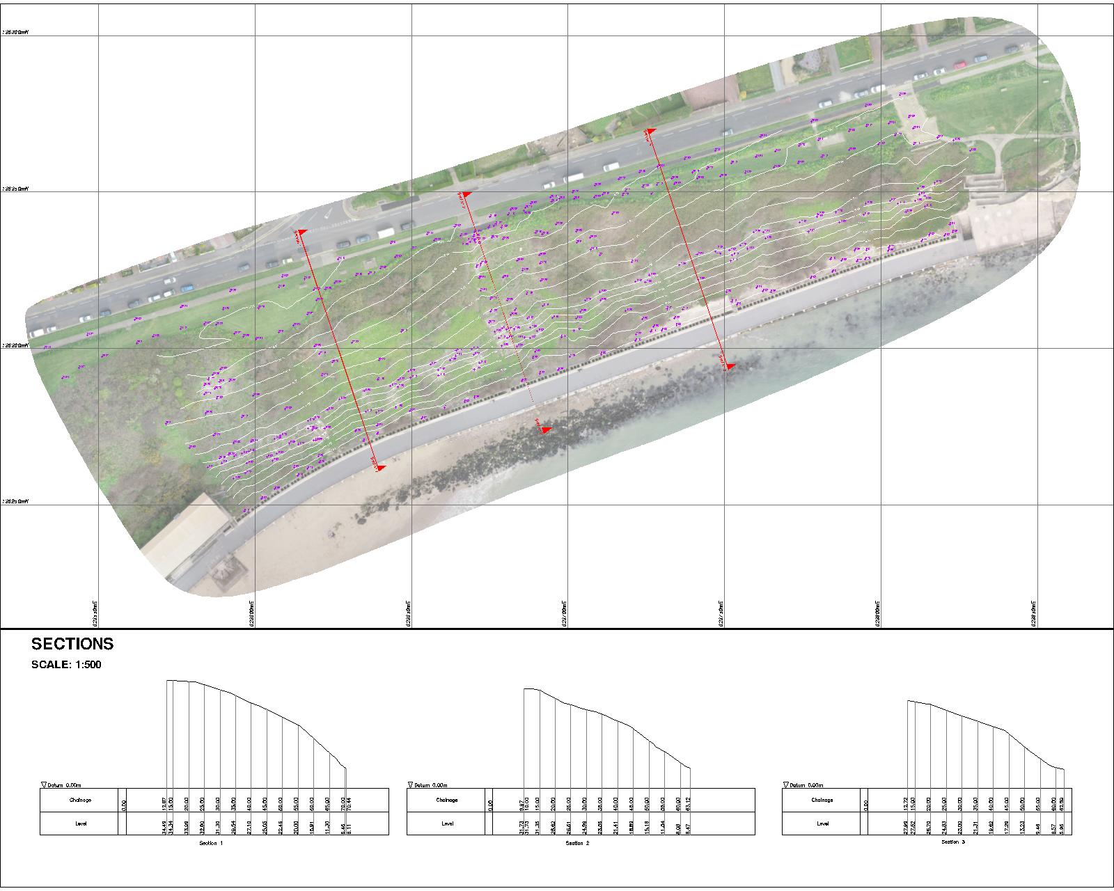
Extract from Sunny Sands Topographical Survey
Some way from the beaches of Kent, we have been working with a major national house builder on a site in Oxfordshire flying the drone to provide data to assist planning by means of infrastructure visualisation.
A first for us was combining our laser scanning output with data captured by drone to create a complete 3D representation, made up of both terrestrial and aerial data, of St Peter & St Paul Church in Chingford.
Other drone projects have included flying a golf course and volume calculations.